

Years ago when I first visited Bangkok, I felt lost, not knowing where to walk.
I looked up famous temples and markets on Google and in guidebooks, but none of them really resonated with me.
The real everyday life and chaos of the city were missing. I felt like I was floating above the city and couldn’t grasp the sense of truly being there.
After spending a few days feeling frustrated, I found a very peculiar map at a local bookstore. I still remember the feeling of "This is it!" when I discovered it.
The map was created by a designer named Nancy Chandler, who hand-drew Bangkok. It recreated even the minor streets with illustrations, filled with handwritten text. Not only did it include the names of shops, restaurants, and historical buildings, but it also had her personal opinions and advice, often humorous.
For example, there was a note on a store selling firearms that said, "Hmm, the world would be a better place if they didn’t sell these." This might be irrelevant information for a tourist looking for sights, but the personal, slightly meddlesome nature of the map immediately endeared me to it.
The next day, I walked around Bangkok with that map in hand. Following her directions, I sometimes found myself wandering into narrow alleys.
“Is this the right way?” I remember feeling like I was chatting with her.
"Subjective Maps" that personalize the city
Since my experience in Bangkok, I have been interested in "subjective maps" created by people who live in the city.
Most maps we use, like Google Maps, guidebooks, and tourist maps, are edited neutrally. They contain "information" but not the "emotions" or "thoughts" of the people living there.
However, our brains do not comprehend cities in their pure form. We don't perceive a city as merely moving from point A to point B; we construct and understand its image by connecting it with our emotions and thoughts.
Kevin Lynch, an American urban planner, discussed this in his book "The Image of the City," published in 1960.
Often, our image of a city is intermittent and mixed with other factors. Here, all senses are fully operational (Lynch, 1960, p 2).
Trivial impressions, experiences, and memories we feel while living in a city. Many fragments obtained through our five senses will eventually disappear without being recorded on a map.
But if we could document and share such subjectivity with others, might we not be able to reinterpret urban spaces from a new perspective? Might we not be able to bring ourselves closer to the city?
For instance, the "USE-it MAP," a tourist map for young people in Europe, is created based on the daily lives and experiences of locals. Instead of famous tourist spots and hotel information, these maps are based on trivial impressions, experiences, and memories felt while living in the city, reflecting the locals' pride and affection for their city. The reader can experience the city from the locals' perspective, and the creators can feel pride in their city. With such accumulation, each person might begin to perceive urban issues as their own.
After studying urban design at a graduate school in Europe and returning to work in Shibuya, Tokyo, I wanted to recreate this sense of "personalizing the city" in Tokyo as well, building a model while referencing other initiatives.
In 2018, I held a workshop in Shibuya, Tokyo, to create "subjective maps" expressing personal experiences, memories, and sensory impressions. Seeing the unique and wonderfully strange maps created by participants, I reaffirmed the importance of understanding the city through one's own emotions and thoughts.
At the same time, I thought this model of creating "subjective maps" could be applied not only in Shibuya but also in other cities.
Personal lenses for understanding the city
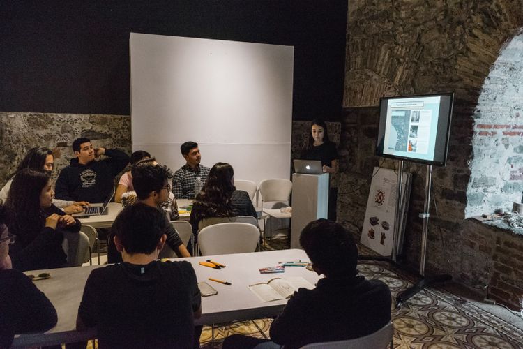
Last month, I had the opportunity to hold a "subjective map" workshop for seminar students at Monterrey Tech's School of Architecture, sponsored by the Mexico-Japan Cultural Center.
Monterrey Tech, a prestigious school in Mexico. The workshop was held on the Puebla campus, a mid-sized city about two hours by car from Mexico City.
The gathered students were 14 undergraduates majoring in architecture. Their seminar instructor was Toshiharu Kawai, a first-class architect based in Kyoto.

The historic downtown of Puebla, damaged by an earthquake a few years ago, has seen little redevelopment and remains deserted. According to the local coordinator, "Recently, no one wants to live there."
So, in the workshop, we attempted to discover and describe the charm of this downtown that no one wants to live in. The students did not analyze the city based on architectural engineering or design theory but reinterpreted the city from personal emotions and memories to create their own prototype of a subjective map.
First, as an icebreaker, we discussed what kind of maps we usually use for what purposes, our favorite maps, and personal episodes related to maps.
Then, we analyzed maps of the downtown area distributed at hotels and tourist information centers in groups. While information about souvenir shops and hotels for tourists was prominent, there was no information about parks, local shops, or walkable streets. Many students pointed out that the presence of pedestrians and residents and the real daily lives of people were missing from official maps.


After the analysis, each student determined their own "perspective" and then went out into the field to create a prototype of a subjective map. The information collected varied among students, such as "the way shadows fall," "my own chill space," "spots where I feel safe," and "the architectural styles and materials of buildings I like."


For example,
- I was interested in the city’s soundscape. The atmosphere changes drastically where there are cars and where there aren’t.
- I realized that the comfort of walking places and uncomfortable streets differ greatly. Thinking about the difference, I found that I am attracted to streets with lots of greenery and just the right amount of shade.
- I unconsciously looked for Instagram-worthy spots while walking.
- Even though it was a short prototype, each student brought their own
Even though it was a short-term prototype, each student brought their unique perspective, and we delved deeply into discussions about "why do we think this way?"


Maps Tell "Stories"
When I tried applying the workshop from Shibuya in the context of Mexico, I was pleasantly surprised by how "similar" it felt.
Of course, the focus varies: in Mexico, many people are concerned with "safety," while in Shibuya, the emphasis is often on "public spaces." However, both contexts demonstrated that creating subjective maps can change how we view the city and reweave the relationship between individuals and their surroundings.
There was also a new realization: what matters is not "what is written" on the maps, but rather training ourselves to cultivate a "critical eye" towards existing spatial representations and experiences.
For example, the French non-profit organization Nomadways which conducts international creative workshops for artists and educators, emphasizes the importance of critical and subjective map-making for social change in their workshop "Subjective Mapping For Social Change."
The maps we usually see are often thought to represent the "truth" of the world, but in reality, they do not. Maps are socially constructed images. Every map has a purpose and tells its own story. Dominant images and discourses significantly influence our perceptions and understandings. This is why the act of creating subjective maps is a method to challenge existing spatial representations and tell different stories (Nomadways 2017).
Researcher Monica Stephens similarly warns that the maps we use daily, believing them to be objective and rational, are actually quite biased.
For example, the Mercator projection maps we commonly see have been criticized for being Eurocentric because they significantly distort the sizes of countries like Africa, South America, and China. Digital maps, which can be updated in real-time, also exhibit significant disparities in accuracy and the information displayed depending on the region. Even Google Maps does not present information rationally; it selectively displays information such as shops based on an individual's past search results.
All maps are edited, and in the process, much is left out. Our perceptions, images, and experiences are heavily influenced by these spatial representations constructed by media and other sources.
Therefore, creating subjective maps that tell our own stories can foster an attachment to the city and serve as a tool to provide alternatives that confront existing spatial representations.


